The A-Z Great Britain Road Map series comprises of five
fold-out road maps which together cover the whole of Great
Britain. Shown at a scale of 5 miles to 1 inch and using a
continuous grid referencing system, it enables several or
all of the sheets to be mounted together whilst retaining
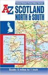
compatibility with the index. This A-Z map of Scotland North
and South is a full colour, double-sided, fold-out road map.
The Northern Scotland map covers the mainland of northern
Scotland from Oban and Perth in the south to Cape Wrath and
John o' Groats in the north including the Isle of Skye, the
Inner Hebrides and the Western Isles. The Orkney and
Shetland Islands are featured in an inset map at a scale of
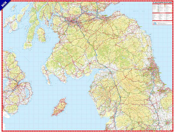
approximately 12.5 inches to 1 mile. The Southern Scotland
map covers the remainder of Scotland southwards and a large
section of Scotland to include Berwick-upon-Tweed,
Newcastle-upon-Tyne, Middlesbrough, York, Skipton,
Fleetwood, Whitehaven and Carlisle. The Isle of Man and part
of Northern Ireland are also covered. Map detail includes
Motorways with full junction detail, Primary routes and
destinations, Service areas, tolls and mileages, Major roads
open, under construction and proposed, Selected minor roads,
A wide range of tourist locations, National Park boundaries
& National and County boundaries. Attached to the cover is
an index booklet which lists cities, towns, villages,
hamlets and locations featured on the maps.. |
||
| 5 miles to 1 inch | 2017 | £5.95 |
 |
 |
 |
 |