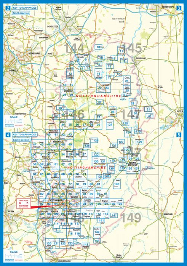
 This county atlas of
Nottinghamshire has 138 pages of street
mapping that features all major towns and villages.
Also included are 6 pages of road mapping covering
the whole county and a large scale city centre map
of Nottingham.
This county atlas of
Nottinghamshire has 138 pages of street
mapping that features all major towns and villages.
Also included are 6 pages of road mapping covering
the whole county and a large scale city centre map
of Nottingham.There is continuous street mapping of the Nottingham, Mansfield, Mansfield Woodhouse, Hucknall, Eastwood, Stapleford and West Bridgford area that extends to include:
There is separate street map coverage of:
|
||
| 3.8 inches to 1 mile | 2013 | £8.95 |
 |
 |
 |
 |